


Allgäu hiking trilogy
The Allgäu hiking trilogy consists of three routes: Wiesengänger, Wasserläufer and Himmelsstürmer. Regardless of whether you only want to walk one stage of the hiking trilogy or undertake the entire circular hike, the trilogy has something for everyone.
The special thing about the hiking trilogy in the Allgäu is that the individual routes are at different altitudes. All routes in the hiking trilogy come with their own special features. But don’t worry, you don’t have to choose just one route, you can also combine them as the hiking trails overlap. Read more about the Allgäu hiking trilogy here.
Far instead of high
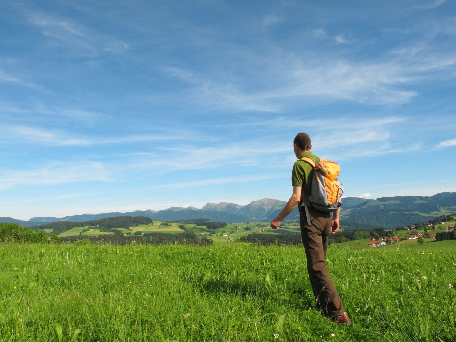
Meadow walker route
The Wiesengänger route runs through the green hilly landscape of the Allgäu. Here you can’t get enough of the extensive meadows and idyllic moorland areas. The panoramic view of the Allgäu Alps is also always at your side as you hike. Along the way of the 424 km long-distance hike, you will also pass picturesque old towns and iconic churches, monasteries and chapels. The Wiesengänger route is therefore not only suitable for nature lovers, but also for culture enthusiasts.
425 km
5.300 m
107 h
Directions
The official starting point of this hike is Marktoberdorf in the Ostallgäu. From here, the route leads through Allgäu old towns such as Bad Wörishofen, Memmingen and Leutkirch. Culture lovers will find countless local museums here, as well as great views of the mountains.
Some of the Wiesengänger stages also run through the Westallgäu, past Waldburg-Zeil Castle, through the Wurzacher Ried to Kißlegg and Wangen. It’s worth stopping off in Wangen to enjoy the picturesque old town. From here, the route continues to Eglofs, where you can plan an overnight stay at the Hotel zur Rose or a stop at our restaurant. The route then continues via Isny and through the Eistobel before winding its way back to Marktoberdorf.
What makes the Water Strider Route special?
If you would like to discover the Allgäu on foot, the 22-stage Wiesengänger hike offers the right mix of nature and culture. The Allgäu is a true paradise for hikers with its gentle mountain meadows and extensive hiking trails. You can completely switch off and enjoy nature while hiking in the Allgäu.
Do you have any questions or requests?
Get in touch – we’ll be happy to advise you and help you make your time out with us really special.

Flying high
Skywalker route
433 km
17.980 m
148 h
Directions
The official starting point of the Himmelsstürmer Route is in Halblech. From here, the hike initially runs parallel to the Wasserläufer route: over the Tegelberg, past the royal castles of Neuschwanstein and Hohenschwangau and on to Füssen. On the way to Oy-Mittelberg, you take in further peaks: the Zirmgrat and the Alpspitz. The route then continues to the Grünten, also known as the guardian of the Allgäu. The towns of Sonthofen, Immenstadt and Oberstaufen are also not to be missed on a multi-day hiking tour in the Allgäu. From there, it’s uphill again to the next famous mountain in the Allgäu: the Hochgrat. Follow the signs downhill towards Balderschwang, the highest municipality in Germany.
The hike continues via Grasgehren to Ofterschwang and Füssen. The route continues along the River Iller to Oberstdorf before reaching the next summit: The Nebelhorn lies at 2,224 meters and is a popular vantage point from which you can see up to 400 peaks with a good view. After the descent, the hike takes you through Bad Hindelang and then makes a detour to Austria. Here you cross the entire Tannheimer Tal valley from Schattwald to Tannheim and Grän. After the Kissinger Hütte, you climb the Aggenstein before crossing the border back to Pfronten.
What makes the Himmelsstürmer route special?
The Himmelsstürmer route is the most challenging hike in the hiking trilogy, but is still the perfect tour for leisure hikers. Despite the many meters in altitude, the tours are suitable for hikers with an average level of fitness.
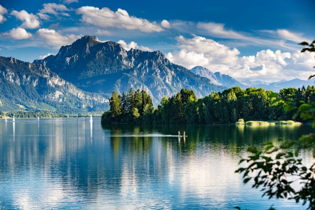
On this hiking tour through the Allgäu, you can enjoy views of rugged mountain peaks, natural lakes and the beautiful Allgäu landscape. At the same time, you will build up your strength and fitness while hiking.
Along the water
Water strider route
The Himmelsstürmer route has plenty of vertical meters. Over 433 kilometers and 24 stages, you collect around 18,000 meters of altitude. The hiking trail takes you through the Allgäu High Alps and the Nagelfluhkette Nature Park. Here you are in the middle of the habitat of rare plant and animal species and an encounter with an eagle or ibex is not uncommon. This hiking route is particularly suitable for summiteers.
433 km
17.980 m
148 h
Directions
The official starting point of the Himmelsstürmer Route is in Halblech. From here, the hike initially runs parallel to the Wasserläufer route: over the Tegelberg, past the royal castles of Neuschwanstein and Hohenschwangau and on to Füssen. On the way to Oy-Mittelberg, you take in further peaks: the Zirmgrat and the Alpspitz. The route then continues to the Grünten, also known as the guardian of the Allgäu. The towns of Sonthofen, Immenstadt and Oberstaufen are also not to be missed on a multi-day hiking tour in the Allgäu. From there, it’s uphill again to the next famous mountain in the Allgäu: the Hochgrat. Follow the signs downhill towards Balderschwang, the highest municipality in Germany.
The hike continues via Grasgehren to Ofterschwang and Füssen. The route continues along the River Iller to Oberstdorf before reaching the next summit: The Nebelhorn lies at 2,224 meters and is a popular vantage point from which you can see up to 400 peaks with a good view. After the descent, the hike takes you through Bad Hindelang and then makes a detour to Austria. Here you cross the entire Tannheimer Tal valley from Schattwald to Tannheim and Grän. After the Kissinger Hütte, you climb the Aggenstein before crossing the border back to Pfronten.
What makes the Water Strider Route special?
The Himmelsstürmer route is the most challenging hike in the hiking trilogy, but is still the perfect tour for leisure hikers. Despite the many meters in altitude, the tours are suitable for hikers with an average level of fitness.
On this hiking tour through the Allgäu, you can enjoy views of rugged mountain peaks, natural lakes and the beautiful Allgäu landscape. At the same time, you will build up your strength and fitness while hiking.